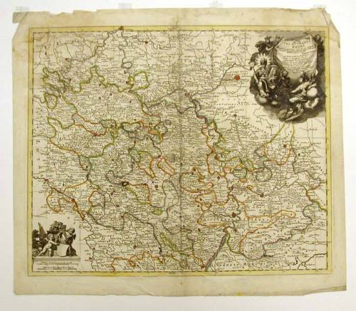
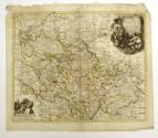


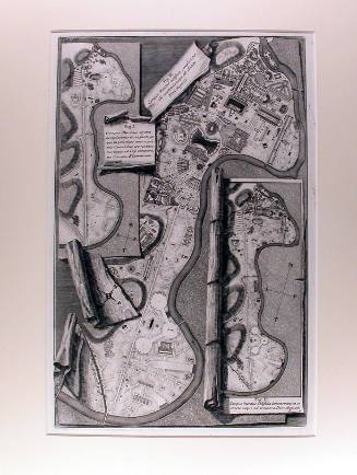
Map: Palatinatus Rheni
Artist
Petrus Schenk I
(Dutch, 1660 - 1711)
DateLate 17th century (?)
MediumEngraving, hand-colored, on paper
DimensionsImage: 18 1/2 x 22 inches (47 x 55.9 cm)
Plate: 19 x 23 inches (48.3 x 58.4 cm)
Sheet: 21 1/2 x 24 5/8 inches (54.6 x 62.5 cm)
Mat: 26 x 28 inches
Plate: 19 x 23 inches (48.3 x 58.4 cm)
Sheet: 21 1/2 x 24 5/8 inches (54.6 x 62.5 cm)
Mat: 26 x 28 inches
Classifications93-Prints (other than 94, 95)
Credit LineGift of the estate of Frank L. Canby
Object number1945.23
On View
Not on viewCollections


Giovanni Battista Piranesi
1762